Yup, Throkda’s been a nickname forever, after a character in a series of stories a friend and I wrote in high school. But when we went hiking, over hill and dale and through thornbushes and mud taking a “shortcut,” I got saddled with being called Throkda Jones. (The Indiana Jones movies were very popular at the time…yes, I’m old)
Today, I got to live out a little bit of my pirate nature, going treasure hunting! Then again, that too relates to Indiana Jones — maybe the Throkda Jones nickname was pretty much on the mark after all… I’ve been interested in geocaching for a few months now, and messed around with the phone GPS a bit, but with results that were a little hit or miss, such as standing around under completely clear blue sky for 20 minutes, waiting for the phone GPS to actually connect to some of the 11 satellites it says are up there, and then only having 50% (and rapidly falling) power left by the time it does….and having to reconnect every time you let the phone go to standby to save power while it’s in your pocket — yeah, not the best experience.
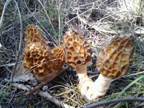
In case the term’s not familiar, geocaching is, in brief, a global treasure hunt. People hide a small container (sometimes only big enough to hold a piece of paper for people to sign, sometimes as large as a person, usually about the size of a peanut butter jar or a military ammunition container), then note its coordinates with their GPS. They post these coordinates, and other people use their GPS to find it — it’s usually out of where people normally travel or look, so that people who aren’t playing the game don’t accidentally find it, potentially stealing the whole cache. When you find it, you usually sign the log-book, and there will often be goodies in the box (keeping it family friendly, so no knives, for example). If you take something, you’re supposed to leave something in trade. Then you re-hide the cache where you found it. It’s a fun game and a good excuse to go outside…and these things are all over the place — even in the city, like behind guard rails or under lamppost skirts.
I had been reading about the GeoMate Jr, which sounded neat as an entry-level GPS. It comes with 250,000 caches preloaded, and you just hit a button to show whatever is the next closest. Simple, and it gets great reviews. But, I also found that it doesn’t have things like the description, hints, and stuff like that — just an arrow and distance….very very simple, since it’s marketed mainly for kids (maybe they assume a parent has a better GPS to get most of the way there).
So, after further research, I got a different entry-level unit, the Magellan eXplorist GC, which is a liitle low-end in that it can’t do some things like import topographic maps, but it does have a basic street map preinstalled, and its ability to sort and work with geocaches directly from geocaching,com looked like it would work out well for me.
So, to summarise, I have a brand new GPS unit, loaded with a bunch of geocaches from state parks near me, as well as a smattering of others, and today I went treasure-hunting with good equipment for the first time! We went to Cleburne State Park, turned on the unit, and within a few seconds of getting to the main screen, it beeped to tell us we had GPS lock. We parked at a trailhead, leashed up the dogs, grabbed our staves, locked the car, and we were on our way!
Our first target was a cache we’d attempted the previous weekend, with the phone GPS. That evening had been entertaining, as we took a straight-line route through dense brush, across an area littered with rusty cans from who knows how long ago (which was kinda cool, since they may have been from an old homestead or CCC camp), and out to a field, where we discovered the main trail did eventually loop around and take you there, much more easily. Then again, when it comes to hiking, I’ve never been that concerned with doing things the easy way — my friends from my childhood had a whole set up superstitious habits when I said things like “shortcut,” “trust me,” or “this way.” We’d been right on top of the cache, but didn’t find it, and since the sun was setting, we gave up and headed back to the car.
Of course, once we were back home, I logged that we didn’t find it, and we saw that someone else took some pictures of their kids holding up a log with a metal plate when they had found it. Brandy glanced at the picture and said she saw that exact log — we had both stepped right over it…d’oh! So this time, we didn’t really need the GPS, as we knew pretty much right where to go after having been right there once before. We arrived at the spot, Brandy turned over the suspected log, and sure enough, we’d found the cache! Not a lot of room in there, so I signed the log paper with the supplied golf pencil, dropped in a sticker from my cache-donation items, and we noted the find in the GPS. Hey, it gave me a little achievement award – “First Traditional Cache Found” — cool! After that, we set it for the next-closest geocache.
Our next target was listed as 0.2 miles away, and it’s description said it was a 6″ long camo container. We started back down the trail, took the other direction where it had forked, and found ourselves walking the fenceline of the park boundary for probably a quarter of a mile before it turned in the right direction and the distance actually started counting down from the original 0.2 miles. Eventually, we arrived in the right vicinity, and the GPS beeped that we were within about 20 feet — which is apparently normal, since different models of GPS, the weather, time of day and such can all cause coordinates to be off by a couple dozen feet when seeking it out.
We were staring at a line of densely-packed cedar trees. The name of the cache was “It’s in there somewhere.” We were looking on the ground right by where we were standing, but couldn’t see much except for branches and needle-like leaves. At one point, Brandy asked if the GPS might have more information for us to puzzle it out. Well, there weren’t any other hints, but I found a setting that made the map hold still to have North be up instead of rotating the map based on our movement. Then I zoomed in to the 25-foot scale, and it showed a solid green line heading southwest on the compass from our current position. The GPS compass also helpfully showed the positions of the sun and moon on the compass dial. It showed the sun as just barely east of due south — we looked up, saw the sun, and I pointed in the exact direction the line pointed according to the compass…and then looked down and saw a faint path at my feet heading in exactly that direction. I think I got whiplash when I smacked my forehead…Sure enough, after pushing through, we found this tiny cache. Um, note to self, bring our own pen in the future….oops.
So we marked that one as found, and told the GPS to find the next closest. Good news, the next one was the official state park cache, and it was only a little over a half-mile away! Bad news, that distance assumed we were swimming across the lake. No problem, we were enjoying ourselves on the boundary trail — we’d turn and go around the lake when there was an intersection. So we started walking. After a while, though, we were grateful to find a bench to take a break on. We gave the pups (and Brandy) some water, and I had a granola bar while screwing around with the map on the GPS, scrolling the cursor around. In addition to the geocache symbols, I found one that looked like a little signpost. What’s this? Hovering the cursor over it, it identified itself as the intersection between the boundary trail and the spillway trail — cool! And one of the caches we meant to hit was on the spillway, so I figured we’d go up to the intersection, then select the CCC spillway cache, and we’d go find it, then cut to the road on the other side of the lake to look for the ones over there on the way back around to the car.
Plan set, we got up and continued our trudge, with Brandy starting to comment about how she needs to work back up to this level of activity again. Well, if I have my way, we’ll be doing a lot more geocaching in the future, so she’ll have plenty of opportunity. When we were about 500 feet from the waypoint according to the GPS, we saw a trail leading toward the lake, with a couple of numbered wooden posts. Did we just find the hike-in primitive camping area? Deciding to check it out, we followed the path, and automatically started sizing up the area for good spots to hang our hammocks. One thing I will say, given the amount of prickly pear cactus in the area, there were more options for the hammocks than there would be for tents….plus, we saw a couple spots on the slope that would overlook the lake! If we ever wanted to try camping backpacker-style for a weekend, this looked like a good option.
We made our way all the way down to the lakeshore, and just walked around for a bit, enjoying the serenity of it all — white gravel, small waves lapping at our feet, and very quiet — there were hardly any people in the park that day. Huyana walked into the water as much as the leash allowed — I think we’re definitely gonna have a good water dog on our hands this time around.
But, we were on our way to the geocache! I started walking back up the hill to get to the trail we had originally planned, when Brandy suggested just following the shoreline. Well, the lake was pretty low, so it shouldn’t be too muddy — yeah, we’ll do that. There was a little mud, and a lot of cattails — one of which Brandy made go poof! White feathery seeds drifted on the breeze for a bit. Huyana tried her best to stay in the water instead of walking with daddy on the shore, and eventually we rounded a bend to see a rock wall, and the course that guided the water to the spillway. The GPS was pointing straight through the reeds, and I asked Brandy if she wanted to do blindly through them or try to go around. She smirked and disappeared into the 8-foot-tall cattails. That’s my girl!
We pushed through, and in no time, we were facing a stone stair-like wall, which the GPS pointed to the other side of. I climbed up, and found myself facing a trail leading across the dam. The GPS pointed just slightly off to the side, though, among some trees. I couldn’t help myself; without waiting for Brandy, I made my way down, and put the GPS in my pocket, since I was within about 30 feet, and started looking around for where a cache might be hidden. At exactly the moment that my eyes fell upon it, the GPS gave its little triumphant chirp to tell me I was at ground zero — like it knew I had just found it.
I opened the cache up and discovered that it was a newer one — I was only the third person to sign the logbook — the first had been on vacation from the Netherlands! And I found another trackable! There are several kinds of these, the most common being Geocoins (coins with a custom design and a serial number), and Travelbugs (dogtags with a serial number, that people usually attached to different small objects). When you log the cache, you can log the trackable separately, whether picking it up, dropping it off, discovering and leaving it there, or finding it in a cache other than the one it was supposed to be in. Usually, you simply move it to another cache, although some have goals for which way they want to go. With logs and pictures, it’s a way to vicariously travel. This one was a little yellow Jeep 4×4 that I later found had travelled around 6,500 miles. I snagged that, and dropped in a deck of Care Bear cards that had somehow come into my possession — I’ve been thinking that as a personal theme for myself, I’d like to drop in game-oriented items when I go geocaching. Since we’re going to Caddo Lake to camp next weekend, I figured I’d move the two trackables in my posession a couple hundred miles from where I picked them up.
Cache rehidden, the next closest was back out to the park road, and across a field. This one was what is referred to as a multi-cache. This is the kind that feels the most like a treasure hunt — the cache isn’t actually at the coordinates in the entry. Instead, you find a clue that you have to solve in order to find the cache, or sometimes the next location with another clue. In this case, it was a large washer hung from a tree with a three digit number etched on it. To find the coordinates of the cache, you had to manipulate the numbers, sometimes the digit itself, sometimes some addition, sometimes subtraction or multiplication, then enter the result into your GPS as a waypoint and go there.
As we were approaching the coordinates with the washer, we heard voices. Sure enough, there was a family over there. I asked if they were geocaching, and in fact they were. They said they were having some trouble reading the numbers, because the washer was rusty and it was badly faded. The parents led the kids and their dog away (ours were going nuts wanting to play), so we could examine the washer ourselves, but they hung around the area so we could compare notes. I took a look, and yeah, this thing was covered in rust and the numbers were barely legible (the top half of two of them was just missing). Later, I read that there was a newer washer in the same area, but we didn’t spot it, nor did we even know to look for it at the time. Fortunately, I did a lot of work with fonts and such for work, so I was able to decipher the numbers from just the segments that were visible — 636. When I passed this information on to the family, they said that made more sense (since one of the final digits involved adding two of these numbers together, and they had guessed 686, which yielded a two-digit number). We first hiked down the road for a bathroom break while I figured up our final coordinates, and hung out for a while, giving the pups more water. After entering the waypoint, I saw that it was on the way to the next cache in the list, the official state park one, and in the direction we’d have to hike to eventually return to the car. I even created a waypoint for where we parked and put a little car icon on the map, just for the fun of seeing how far away the car was. Sitting there, it was 1.1 miles away…directly across the lake.
Feeling a little rested, we started walking down the road, and eventually, the arrow pointed off to one side, across a field, saying it was 500 feet away. Given that part one was just a little ways into the treeline on the far side of a field, I figured this one might be as well, so I just started cutting across the field. Brandy didn’t follow — she told me later she was looking for a trailhead instead. As I got closer, I heard voices again, and sure enough, the family was coming out of a trail leading into the treeline I was headed towards. We exchanged hellos, and I started down the trail as they continued the other way, looking for their next cache. When I was about 50 feet away, the arrow was pointing directly into thick undergrowth, which meant more bushwhacking for me. I started pressing through, Huyana faithfully following, and emerged…on another trail. Figures. I went a little bit down this trail, until the arrow pointed into the thicket again, and found a path that was a little less overgrown, leading to the cache. This time, it was a large flashlight — I couldn’t help myself, I pressed the button, but of course nothing happened. This particular one was simply disguised as a lost flashlight. Opened it up….and yet again, a logbook, but no included writing utensil — I really need to carry a pen when I do this. The GPS gave me a new achievement – “First Multi-Cache Found!” I dropped in a toy top, closed it back up, and walked back to the trail, intending to go look for Brandy, and she was conveniently just then coming down the trail toward me. I asked if she wanted to see the cache, which she did, so I got her to the general area and pointed her in its direction — she found it quickly enough, and we both commented on the clever container.
Next cache, the state park one! Brandy was really starting to feel tired, though, so we walked slowly up the road, with our goal to get to one of the day use spots with a picnic table to pause and take another break. On the way, a ar pulled up to us, and it was that family — apparently, they hadn’t actually found the multi-cache, and asked me where it was — when I mentioned it was under a low tree branch behind a rock, the father said he knew right where it was, and they drove on. That amused me, as I’d only been using my GPS for a few hours, and they seemed to be a little more experienced at it.
After a while, we rounded a bend, and saw a bench facing the water, so we sat down. The cache was within 300 feet, but we’d have to continue down the road to a trailhead and backtrack to get to it. Brandy had pointed out a trailhead on the way up, and it was the correct one, but it was also the far end, and at the time, my priority had been finding a picnic table or something so she could sit for a while. As we relaxed and looked at the water, Brandy showed me a large burst blister on her foot. I expressed concern, given how far the walk was to the car, but she insisted she’d be fine. A little while later, she was feeling the pain a bit more, so I put my foot down, and said we were done for the day – I would go get the car. That’s where my most adventurous hike of the day began, and also where the true benefit of the GPS showed itself…yup, I let the Throkda Jones in me fully take over.
You see, if I followed the road like a sensible person, it would veer away from and back toward the lake, making my walk much much longer. I could see this on the GPS street map. So, at the first opportunity, when I saw a trail leading down toward the lake, I cut down that, following the waterline on a path that cut some distance, but eventually dumped me back on the road when it veered back. After doing this twice, I found myself striding directly across the picnic area to the swimming beach and on to the fishing pier/boat dock. Once there, thanks to the low water level, I hopped down to the gravel (thus putting me on the “other side” of the lake. Unfortunately, after following this for a little bit, I ran out of navigable land, as dense plants came all the way up to the water’s edge of the creek I was now following (where people would paddle up in their kayaks). Well, since I couldn’t continue walking this way, I had to cross the creek back to the other side.
I spotted a beaver dam, and walked across that, carefully balancing with my staff to avoid falling in the mud and water. On the far side, I saw some crushed reeds where someone else had done the same, and I started up the shore. My first step, the reeds weren’t quite on the solid ground I assumed — gloosh! Meh, one wet sock — they almost held my weight! I cut across a camping loop, where some people at their site watched me emerge with an expression like “what the hell?”
With rapid strides (and Huyana was loving this), I cut past the group barracks and back down to the creek, looking for where it was narrow enough for me to hop across. When I found it, I first had to hop across a narrow branch, landing on a bank that was 4 feet lower than the ground I started from…poor dog went under, which meant I had to unhook the leash, and reconnect it once we were both there. There, we’d cut about three quarters of a mile off my walking distance with that one hop. Now, back up onto the road, passing some surprised RV campers, I continued on my way, watching the GPS for options where I could take a straight-line shortcut instead of following the road. Soon enough, I came across another one, this time following the easement under some electrical lines, up the rocky hillside, over stumps and cacti and through some brush when the path dipped into a ditch, until finally, I dropped back onto the road on the final stretch toward the car. Total time to get to the car, about 20 minutes. Total time to drive back, following the road at 20 miles an hour, about 5 minutes. Plus I got another achievement – “Travelled 5 miles!”
I picked Brandy up, and we headed home, happy and excited with our success. Yeah, I’m really gonna enjoy this particular hobby..